
Spring Rain Sets Marin’s Detection Clock
Phytophthora ramorum leaves a narrow opening for detection. In Marin County, the useful sampling period generally runs from late April to mid-May, when spring rain and sustained ambient temperatures between 65°F and 75°F support active pathogen sporulation.
Organizers tracked local weather station readings rather than choosing a survey date months in advance. They waited for a sequence of late spring rain events, then watched for temperatures to hold within the sampling range. That timing increased the chance that symptomatic California bay laurel leaves would yield viable material for diagnostic testing.
The result carried consequences beyond the survey weekend. Marin County volunteers identified a new Sudden Oak Death hotspot before widespread oak mortality became visible. That lead time gave local land managers an opportunity to focus management and prevention work around susceptible mature trees while the affected area remained actionable.
The Spring Signal: Rain starts the clock. Sustained mild temperatures tell survey coordinators when field sampling can capture active sporulation.
This is why SOD Blitz surveys function as more than public education. Fragmented coastal woodlands exceed the practical reach of a small professional field staff. A trained community can watch more access points during the brief biological window that matters. In Marin’s terrain, that network provides the most effective available early warning system for local forest managers.
Marin’s Trail Network Became a Survey Grid
The monitoring coalition brought together homeowners, naturalists, and land trust members. Each group knew a different part of the area: neighborhood paths, preserve entrances, shaded drainages, and stands where bay laurels grew close to coast live oaks.
Their shared challenge was scale. Marin’s coastal forests break across residential parcels, steep ravines, public trails, and dense understory. Poison oak and blackberry brambles restrict movement. Even a well-planned route can become impassable within a few meters of a path.
Coordinators began with rigid grid coordinates for volunteer assignments. That plan lasted through the first morning. Straight-line transects sent participants toward steep coastal ravines and vegetation they could not safely cross, so organizers shifted permanently to trail-buffer monitoring. Volunteers surveyed accessible ground extending 10 to 15 meters from established paths.
What Volunteers Looked For
Field attention centered on California bay laurel, a key host used in SOD surveillance. Volunteers moved slowly along trail edges, turning leaves to inspect their tips and margins for necrotic tissue. In dense understory, the task involved repeated close observation rather than covering distance quickly.
That accessible buffer produced a workable compromise. It could not represent every concealed slope, yet it created repeatable coverage across terrain that professionals alone could not monitor during the short spring window. Local knowledge guided volunteers toward bay laurel clusters, while the shared protocol kept observations comparable from one route to the next.
How a Bay Laurel Sample Becomes Usable Evidence
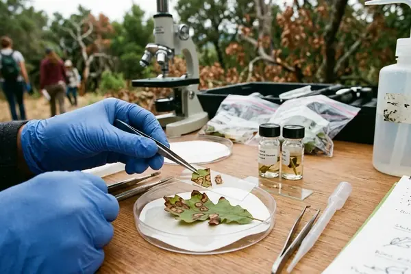
A brown leaf tip can direct a volunteer’s attention. It cannot establish the presence of P. ramorum. Native fungi may produce lesions that look visually identical, making diagnostic confirmation the decisive step.
Collect Across the Cluster
The Marin protocol required volunteers to collect from multiple distinct bay laurel trees in a cluster. Pulling every leaf from one heavily affected branch would provide a narrow sample and could reduce the value of the submission.
- Confirm the target species. The sampler first identifies California bay laurel and inspects leaves for necrotic tips or margins consistent with the survey guidance.
- Keep trees distinct. Volunteers move through the cluster and gather material from separate bay laurels instead of treating one branch as representative of the whole site.
- Collect enough viable material. Each sampled tree contributes 5 to 10 symptomatic leaves, following the instructions in the standardized collection packet.
- Record the location. Mobile mapping tools capture GPS coordinates with an accuracy of 3 to 5 meters. This allows researchers to connect a confirmed result to a usable point in the area.
- Submit for testing. The field packet moves into the testing workflow. Polymerase chain reaction testing then determines whether the sample contains P. ramorum.
PCR Sets the Threshold: Leaf symptoms guide collection; molecular testing establishes pathogen presence.
All volunteer-collected material requires rigorous diagnostic verification. Field identification remains an observation, even when a lesion appears characteristic. The dependency on PCR is central to the protocol because native fungi can mimic the same visible damage. Readers examining the technical standard can review the diagnostic confirmation protocols used in Sudden Oak Death research.
Standardized packets make the handoff possible. Every participant receives the same collection instructions and location requirements, reducing variation between routes. GPS tagging then turns a positive test result into a site that researchers and land managers can find again.
Leaf symptoms alone remain ambiguous. That scope limit protects the credibility of community science data. Volunteers locate and document possible disease activity; plant pathology testing rules out false positives before the finding enters management decisions.
A Confirmed Hotspot Narrows the Management Zone
Diagnostic confirmation changed the question in spring 2023. Managers no longer needed to ask whether the pathogen was present at the sampled site. They needed to decide which nearby hosts to address first.
Area-wide eradication was set aside. The response instead concentrated on small, understory bay laurels growing immediately beside high-value mature coast live oaks. These bay laurels can support pathogen activity close to susceptible oak trunks, so their position made them a practical management priority.
Two Focused Actions
- Create separation around oaks. Land managers cleared bay laurels within a 15- to 20-foot radius of susceptible oak trunks.
- Schedule dry-season treatment. Topical phosphite bark sprays were applied between late August and early October, when the treatment work could occur during the dry season.
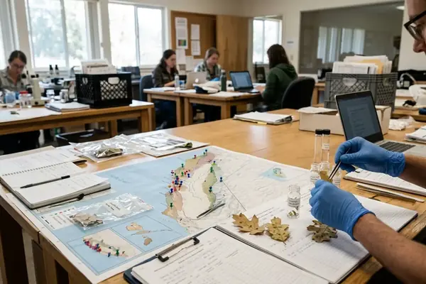
The division of labor stayed clear. Citizen scientists found symptomatic host material and supplied georeferenced samples. Diagnostic testing confirmed the pathogen. Local land managers then used that verified location to target bay removal and phosphite treatment around mature oaks.
Early detection made this narrow intervention possible. Crews could work around a known hotspot rather than wait for broad canopy decline to reveal a larger problem. The approach directed limited field capacity toward the trees and host relationships most relevant to immediate woodland conservation.
Build the Next SOD Blitz Block by Block
Other coastal communities can adapt the Marin model by organizing at neighborhood scale. The useful monitoring unit is a connected group of residents who share nearby paths, bay laurel stands, and collection points.
Recruitment works best when it reaches people close to the survey ground. Marin organizers shifted from broad county-wide appeals to neighborhood association meetings, allowing coordinators to assemble contiguous monitoring blocks rather than scatter individual volunteers across distant sites.
A Practical Local Setup
- Start with a walkable area. Map established paths and define trail-buffer zones extending 10 to 15 meters into accessible vegetation.
- Train before sampling. Schedule a field session lasting about 1.5 to 2 hours so participants can practice target-species identification, leaf selection, GPS recording, and safe movement around poison oak and brambles.
- Use one collection standard. Provide uniform packets that specify the number of leaves per tree, the need to sample multiple trees, and the location data required for testing.
- Keep submission simple. Place centralized collection bins at local fire stations for 48 to 72 hours after the blitz. A short, known drop-off period keeps samples moving through a common intake route.
Upcoming local SOD Blitz surveys offer a direct entry point for residents who already walk these woodland edges. A volunteer does not need to diagnose the pathogen. The useful contribution is careful observation, disciplined collection, and an accurate location that the testing team and land managers can act upon.
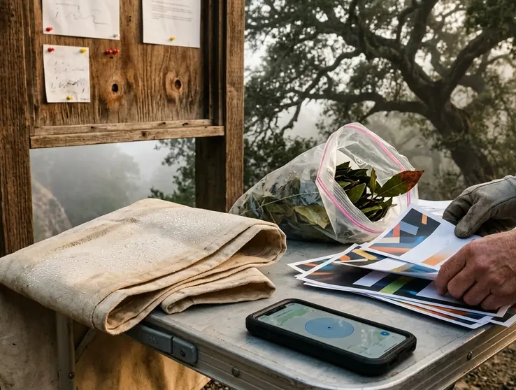
Morning mist hangs over a Marin trail as a volunteer stops beside a bay laurel. One rain-soaked leaf carries a darkened tip. The volunteer collects it with the rest of the tree’s sample, secures the packet, and waits for the mapping tool to enter the required accuracy range. Above the ravine, a mature coast live oak stands within sight.



Your Thoughts
No comments.
Leave a Comment